The Qhapaq Ñan is the road network of the Inca Empire: more than 30,000 km of roads that linked Cusco, its capital, with the whole empire, across what are today Colombia, Ecuador, Peru, Bolivia, Chile and Argentina. Built by the Incas, partly on older roads, and extended above all in the 15th century, it carried armies, officials, goods and messengers across mountains, deserts and forests. In 2014 UNESCO declared it a World Heritage Site, shared by the six countries. The Inca Trail to Machu Picchu is one of its best-known sections.
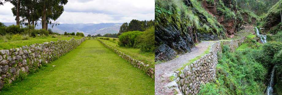
Qhapaq Ñan facts#
| Qhapaq Ñan | |
|---|---|
| Meaning | In Quechua, ñan is road and qhapaq means rich or powerful; UNESCO translates it as “Main Andean Road” |
| Length of the network | More than 30,000 km |
| Countries today | Colombia, Ecuador, Peru, Bolivia, Chile and Argentina |
| Built | By the Incas, partly on pre-Inca roads; greatest expansion in the 15th century |
| World Heritage | Since 21 June 2014 (UNESCO session in Doha) |
| What UNESCO listed | A selection of 137 road segments, about 700 km in all, with 273 associated sites |
| In Peru | About 250 km in 54 sections, with 82 archaeological sites |
Sources: UNESCO World Heritage Centre (2014 decision and site description) and the Qhapaq Ñan programme of Peru’s Ministry of Culture. Estimates of the total length vary: some sources give 23,000 km and others 40,000 km.
How the network was organised#
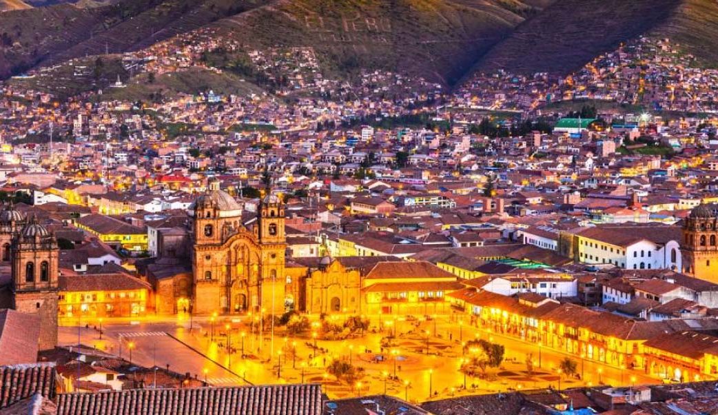
Four main roads left the central square of Cusco, Hauk’aypata, today’s Plaza de Armas, towards the four quarters (suyus) of the empire, which the Incas called Tawantinsuyu, “the four parts together”:
- Chinchaysuyu, to the north, towards Quito
- Antisuyu, to the east, towards the Amazon forest
- Qollasuyu, to the south, the largest, towards Lake Titicaca, Chile and Argentina
- Kuntisuyu, to the west, the smallest, towards the Pacific coast
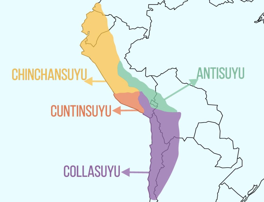
Two great roads ran the length of the empire, one through the Andes and one along the coast, joined by transverse roads. The Andean road is clearest from Quito, in Ecuador, to Mendoza, in Argentina.
How the Incas built the roads#
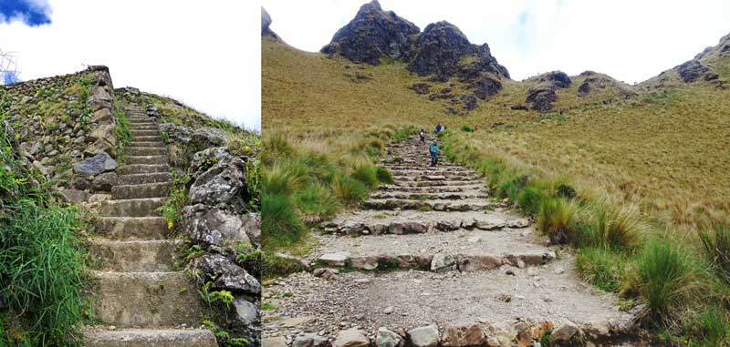
The Incas built without iron tools, the wheel or draught animals, and adapted each road to the ground. UNESCO and its advisers describe paved roads, roads on terraces or between walls, paths cut into the rock, stairways and causeways over wet ground, with retaining walls, ditches and drains to carry the rain away. Rivers were crossed on stone bridges or on bridges hung from ropes. Most roads were one to four metres wide; the main road between Cusco and Quito was much wider in places.
Tambos, qollqas and chaskis#
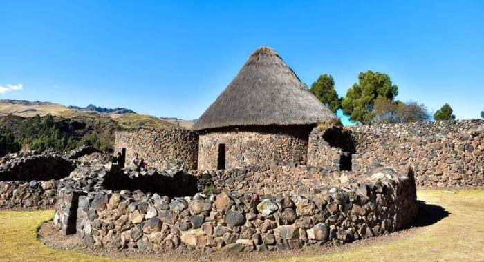
Along the roads, about a day’s walk apart, the Incas built some 2,000 tambos: way stations where officials, soldiers and travellers on state business found food and shelter. Next to many of them stood qollqas, storehouses of food, cloth and weapons. Raqchi, south of Cusco, still has rows of round qollqas.
News travelled by chaskis, relay runners posted in small huts along the roads, who carried spoken messages and khipus, the knotted cords the Incas used for records. Each ran a short stage and passed the message to the next. A message is said to have covered the 2,500 km between Quito and Cusco in about a week, some 240 km a day. The chronicler Felipe Guaman Poma de Ayala drew them in his illustrated chronicle of 1615.
The Q’eswachaka bridge#
The last Inca rope bridge, Q’eswachaka, spans a gorge of the Apurímac river in the district of Quehue, province of Canas, south of Cusco. It is about 30 m long, and every year, in June, four communities take three or four days to replace it with new ropes braided from grass, as their ancestors did. UNESCO recognised this renewal as Intangible Cultural Heritage in 2013, and the bridge is also one of the sections of the Qhapaq Ñan World Heritage Site.
The Qhapaq Ñan as World Heritage#
The World Heritage Site does not cover the whole network but a selection of sections that UNESCO considers representative of it, with their bridges, way stations and settlements. Near Cusco the listed sections include:
- The Plaza de Armas of Cusco itself, the Inca square of Hauk’aypata
- Rumiqolqa–Andahuaylillas and Oropesa–Piñipampa, on the road south-east of Cusco
- Machaqmarka–Raqchi, with the qollqas of Raqchi
- Patacancha–Huacahuasi, in the Lares valley
- Tawis–Puente Ollanta, near Ollantaytambo
- Vitkus–Abra Choqetakarpu and Kutacoca–Choquequirao, in the Vilcabamba region
- The Q’eswachaka bridge
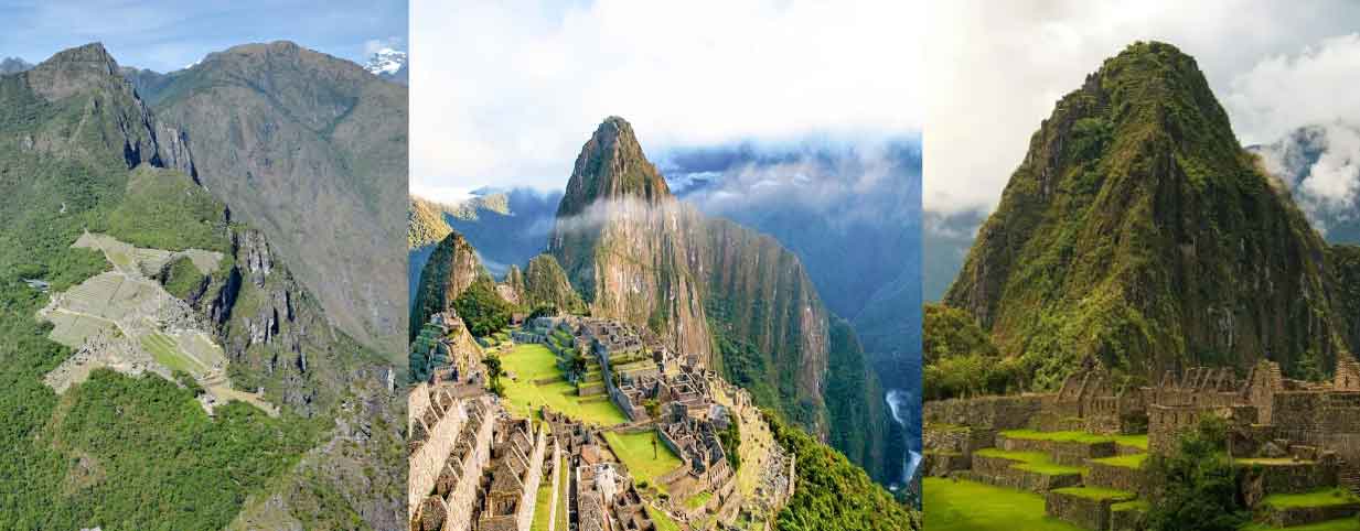
The Inca Trail to Machu Picchu is part of the same Inca road system but is not among the sections listed in 2014. It is protected inside the Historic Sanctuary of Machu Picchu, a World Heritage Site since 1983, whose listing mentions its road and trail system.
Walking the Inca roads today#
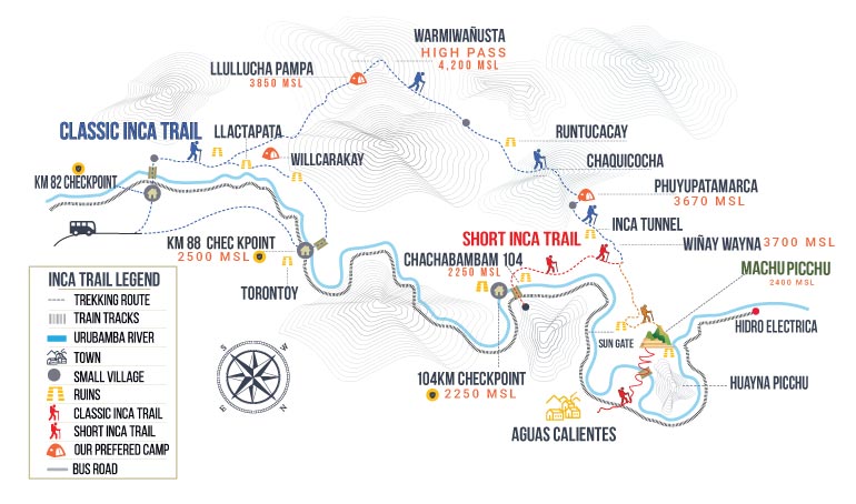
- The Inca Trail, from Km 82 to Machu Picchu, follows 42 km of Inca road over the Dead Woman’s Pass (4,215 m) and past Inca sites, and enters the citadel through the Sun Gate. It needs a permit: see our Inca Trail guide and the Classic Inca Trail 4 Days.
- The Short Inca Trail, from Km 104, walks the last 10 km of the same road, past Wiñay Wayna, in one or two days: see the Short Inca Trail 2 Days with Hotel and the 1-Day Inca Trail.
- The Inca Jungle Trek in 4 days spends a day on an old Inca path between Santa María and Santa Teresa: see the Inca Jungle Trek 4 Days.
- The Lares Trek visits Huacahuasi, at one end of the listed Patacancha–Huacahuasi section: see the Lares Trek.
- Choquequirao, the Inca site in the Apurímac canyon, is reached only on foot: see our Choquequirao treks.
Frequently asked questions#
How long is the Qhapaq Ñan?
UNESCO puts the whole network at more than 30,000 km. The World Heritage Site covers a selection of about 700 km of road in 137 segments.
Is the Inca Trail part of the Qhapaq Ñan?
Yes, it is a section of the Inca road network. For World Heritage it is protected as part of the Historic Sanctuary of Machu Picchu (1983), not in the Qhapaq Ñan listing of 2014.
Who built the Qhapaq Ñan?
The Incas, who joined and extended older Andean roads, above all in the 15th century under Pachacútec and his son Túpac Inca Yupanqui, until the Spanish conquest in 1532.
Can you still walk the Inca roads?
Yes. Near Cusco the best-known walks are the Inca Trail to Machu Picchu, in 1, 2 or 4 days, and the treks to Lares and Choquequirao. More about the Inca road builders is in our guides to the history of Machu Picchu and the archaeological sites in Cusco.

Written by Joel Cárdenas Gonzales
Founder & CEOFounder and CEO of Southern Peru Explorers since 2009. Born in Cusco and trained as an official tour guide at Instituto Khipu. About the author