Table of Contents (10 Sections)
- 1 The route day by day at a glance
- 2 Altitude of each point on the Salkantay Trek
- 3 Day 1: Challacancha to Soyrococha
- 4 Day 2: over the Salkantay Pass to Qollpapampa
- 5 Day 3: Qollpapampa to Lucmabamba
- 6 Day 4: Llactapata to Hidroeléctrica and Aguas Calientes
- 7 Day 5: Machu Picchu
- 8 The 7-day route: Salkantay and the Inca Trail
- 9 Plan your Salkantay Trek
- 10 Frequently asked questions
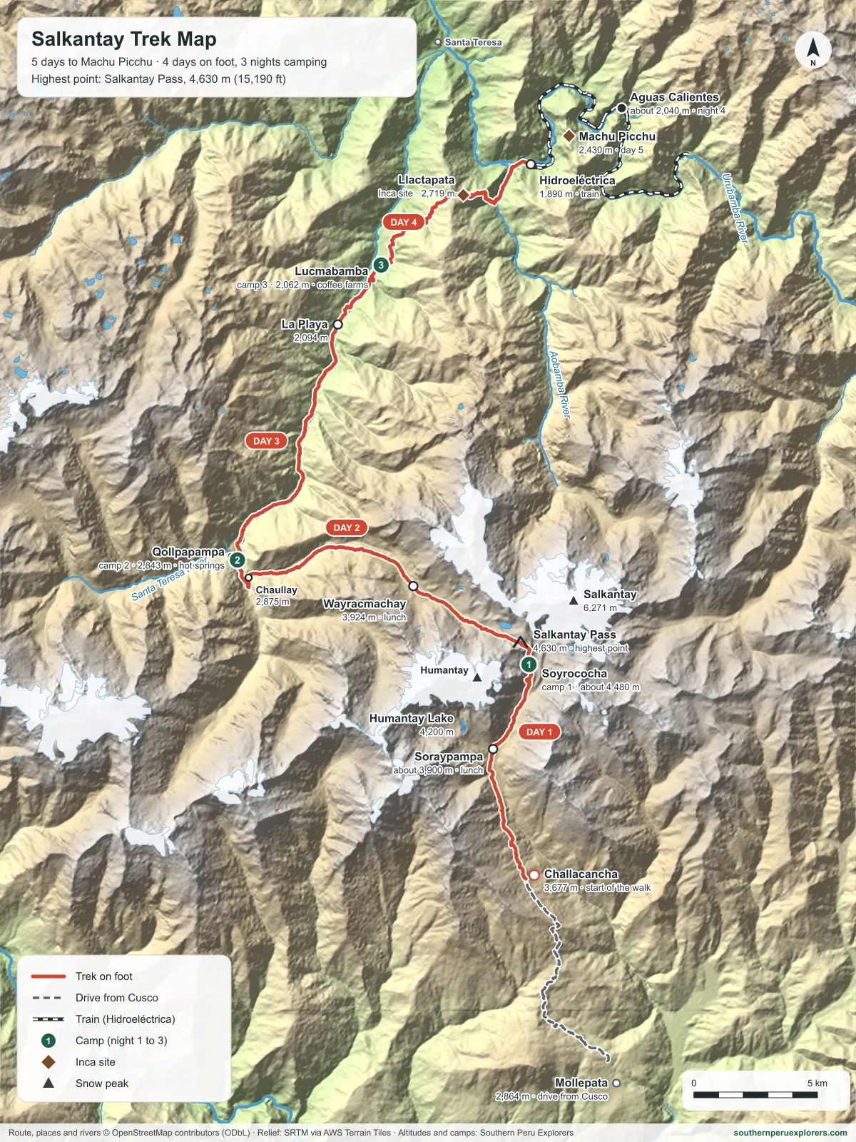
The Salkantay Trek starts at Challacancha, above the village of Mollepata, climbs past Soraypampa to a camp below the Salkantay glacier and crosses the Salkantay Pass (4,630 m / 15,190 ft), its highest point, on day 2. From there it drops into the cloud forest to Qollpapampa and Lucmabamba, crosses the ridge of Llactapata, with its Inca site and first view of Machu Picchu, and reaches Hidroeléctrica, where the train runs to Aguas Calientes. Day 5 is Machu Picchu. In all it is about 74 km in four days of walking. This is the route of our Salkantay Trek 5 Days to Machu Picchu.
The route day by day at a glance#
| Day | Route | Walking | Highest point | Night |
|---|---|---|---|---|
| 1 | Challacancha – Soraypampa – Soyrococha | About 10 km, 6 hours | Soyrococha, about 4,480 m | Camp near the glacier, the coldest night |
| 2 | Soyrococha – Salkantay Pass – Wayracmachay – Qollpapampa | About 9 hours | Salkantay Pass, 4,630 m | Camp at Qollpapampa (2,843 m), with hot springs |
| 3 | Qollpapampa – Chaullay – La Playa – Lucmabamba | Mostly downhill | Qollpapampa, 2,843 m | Camp at Lucmabamba (2,062 m), among coffee farms |
| 4 | Lucmabamba – Llactapata – Hidroeléctrica; train to Aguas Calientes | About 5 hours | Llactapata ridge, about 2,750 m | Lodge in Aguas Calientes |
| 5 | Machu Picchu; train to Ollantaytambo and transport to Cusco | Guided visit of about 2 hours | Machu Picchu, 2,430 m | – |
Times and camps from our 5-day itinerary.
Altitude of each point on the Salkantay Trek#
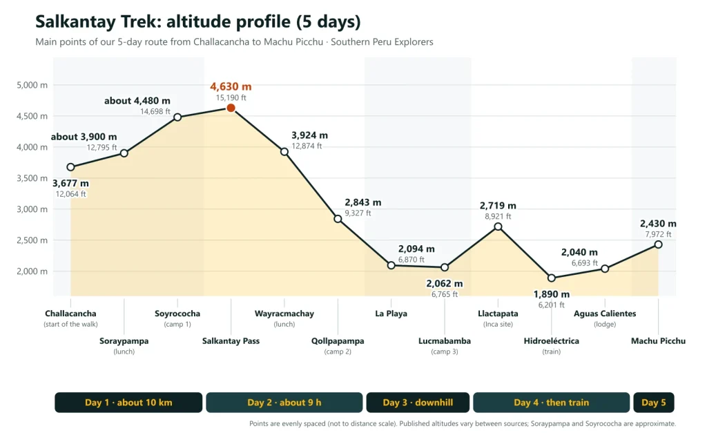
| Point | Altitude |
|---|---|
| Mollepata (village on the drive from Cusco) | 2,864 m (9,396 ft) |
| Challacancha (start of the walk) | 3,677 m (12,064 ft) |
| Soraypampa (Salkantaypampa) | About 3,900 m (12,795 ft) |
| Humantay Lake, above Soraypampa | 4,200 m (13,780 ft) |
| Soyrococha (camp 1) | About 4,480 m (14,698 ft) |
| Salkantay Pass | 4,630 m (15,190 ft) |
| Salkantay peak | 6,271 m (20,574 ft) |
| Wayracmachay | 3,924 m (12,874 ft) |
| Qollpapampa (camp 2) | 2,843 m (9,327 ft) |
| Chaullay | 2,875 m (9,432 ft) |
| La Playa | 2,094 m (6,870 ft) |
| Lucmabamba (camp 3) | 2,062 m (6,765 ft) |
| Llactapata (Inca site) | 2,719 m (8,921 ft) |
| Hidroeléctrica (train station) | 1,890 m (6,201 ft) |
| Aguas Calientes | About 2,040 m (6,693 ft) |
| Machu Picchu | 2,430 m (7,972 ft) |
Villages from Peru’s national census of populated places (INEI, 2017); Humantay Lake and Llactapata from the tourism inventory of MINCETUR; Hidroeléctrica from PeruRail; the pass, Soraypampa and Soyrococha from our itinerary and maps, where published figures vary by a few tens of metres.
Day 1: Challacancha to Soyrococha#
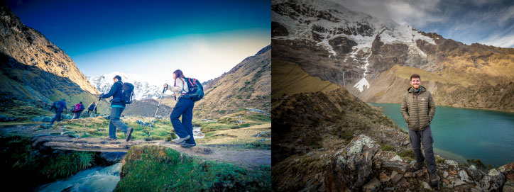
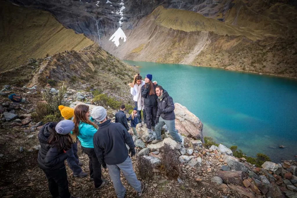
We leave Cusco at about 5:00 a.m. and drive for about four hours through Limatambo and Mollepata to Challacancha, where the wranglers and horses join us. A gentle climb leads to Soraypampa for lunch, below the peaks of Humantay and Salkantay, and a steep climb of about two hours to the camp at Soyrococha, close to the glacier. About 10 km and 6 hours of walking. We visit Humantay Lake, a glacial lake at 4,200 m above Soraypampa; its entrance (S/ 20) is paid separately: read our guide to Salkantay and Humantay Lake.
Day 2: over the Salkantay Pass to Qollpapampa#
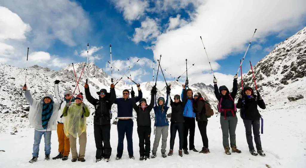
The hardest day: about 3.5 hours up to the Salkantay Pass, at 4,630 m, with the glaciers of Salkantay (6,271 m) beside you, then about 2 hours down to Wayracmachay, at the edge of the cloud forest, for lunch. In the afternoon the trail keeps descending, with traces of an old Inca path, to the camp at Qollpapampa, which has natural hot springs. About 9 hours of walking and a descent of almost 1,800 m from the pass.
Day 3: Qollpapampa to Lucmabamba#
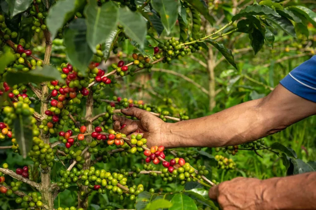
A mostly downhill day along the Santa Teresa and Totora rivers, from the dry highlands into the cloud forest, with orchids, bromeliads, waterfalls and fruit and coffee farms. The route passes Chaullay, the Coripacchi waterfalls, Wiñaypoko and the town of La Playa, and ends at the camp in Lucmabamba, among the coffee plantations.
Day 4: Llactapata to Hidroeléctrica and Aguas Calientes#
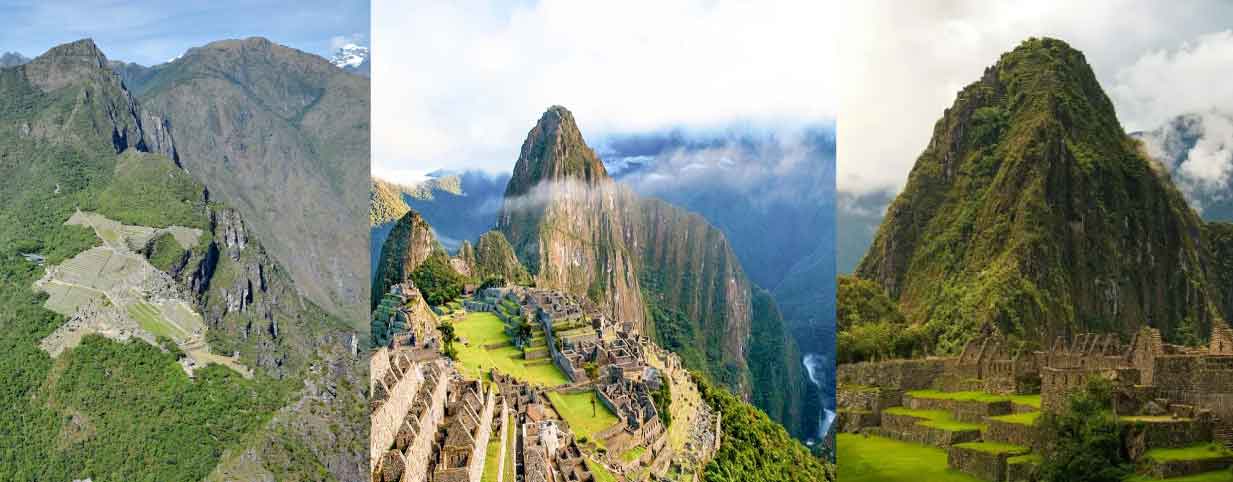
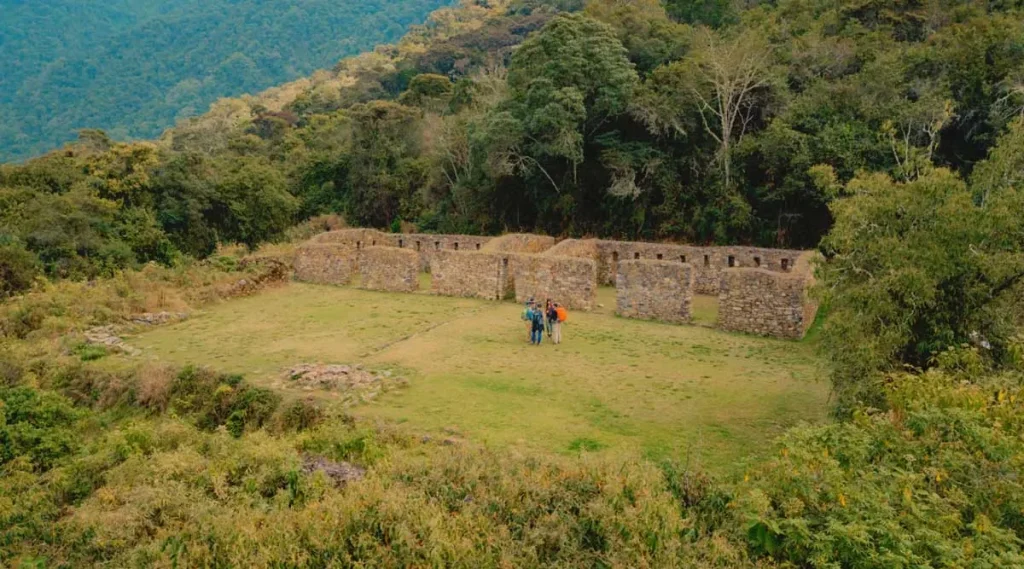
About two and a half hours uphill to the viewpoint on the Llactapata ridge, at about 2,750 m, with views of Machu Picchu and the valleys around it, and lunch near the Inca site of Llactapata, from which Machu Picchu and Salkantay can be seen in the same view. Then about two hours down along the Aobamba river, through bamboo forest, orchards and coffee farms, to Hidroeléctrica, where we take the train to Aguas Calientes. About 5 hours of walking.
Day 5: Machu Picchu#
An early bus (not included) takes you up from Aguas Calientes to Machu Picchu (2,430 m) for a guided tour of about two hours, with free time afterwards or the climb of Huayna Picchu or Machu Picchu Mountain if you booked it. In the afternoon the Expedition train runs to Ollantaytambo, and our transport takes you back to your hotel in Cusco.
The 7-day route: Salkantay and the Inca Trail#
Our 7-day trek starts like the Salkantay Trek, crosses the Incachiriasca pass (4,850 m), its highest point, and joins the Inca Trail at Wayllabamba, then crosses the Dead Woman’s Pass to reach Machu Picchu through the Sun Gate. See our guide to the Salkantay and Inca Trail in 7 days and the Inca Trail and Salkantay Trek 7 Days.
Plan your Salkantay Trek#
- The best months are May to October, the dry season. Read our Salkantay Trek guide.
- Spend at least two days in Cusco before the trek: the first night is near 4,500 m.
- See what the trek costs and includes in our Salkantay Trek prices, or compare all our Salkantay treks.
Frequently asked questions#
How long is the Salkantay Trek?
About 74 km in four days of walking, plus a fifth day at Machu Picchu. The longest walking day is day 2, about 9 hours over the pass.
What is the highest point of the Salkantay Trek?
The Salkantay Pass, at 4,630 m (15,190 ft), on day 2. The first camp, at Soyrococha, is also high, at about 4,480 m.
Where do you sleep on the Salkantay Trek?
In camps at Soyrococha, Qollpapampa and Lucmabamba on the first three nights, and in a lodge in Aguas Calientes on the fourth.
Do you walk to Aguas Calientes?
On our route, no: after Llactapata we walk down to Hidroeléctrica and take the train to Aguas Calientes.

Written by Joel Cárdenas Gonzales
Founder & CEOFounder and CEO of Southern Peru Explorers since 2009. Born in Cusco and trained as an official tour guide at Instituto Khipu. About the author