This guide is continuously maintained and verified by our resident Andean mountain leaders, ensuring accurate permit guidance, altitude protocols, and route recommendations for travelers in Peru.
Table of Contents (5 Sections)
The highest point of the Inca Jungle Trek is Abra Málaga, at about 4,300 m (14,108 ft), which you reach by bus on day 1. From there you ride a bike downhill into the warm valleys around Santa María, at about 1,200 m (3,900 ft), the lowest point of the route. The rest of the trek stays between about 1,200 and 2,430 m: the Inca path of day 2 climbs to about 2,000 m, Santa Teresa is at 1,550 m, Aguas Calientes at 2,040 m and Machu Picchu at 2,430 m. The profile and table below show each point, day by day, for the 4-day tour.
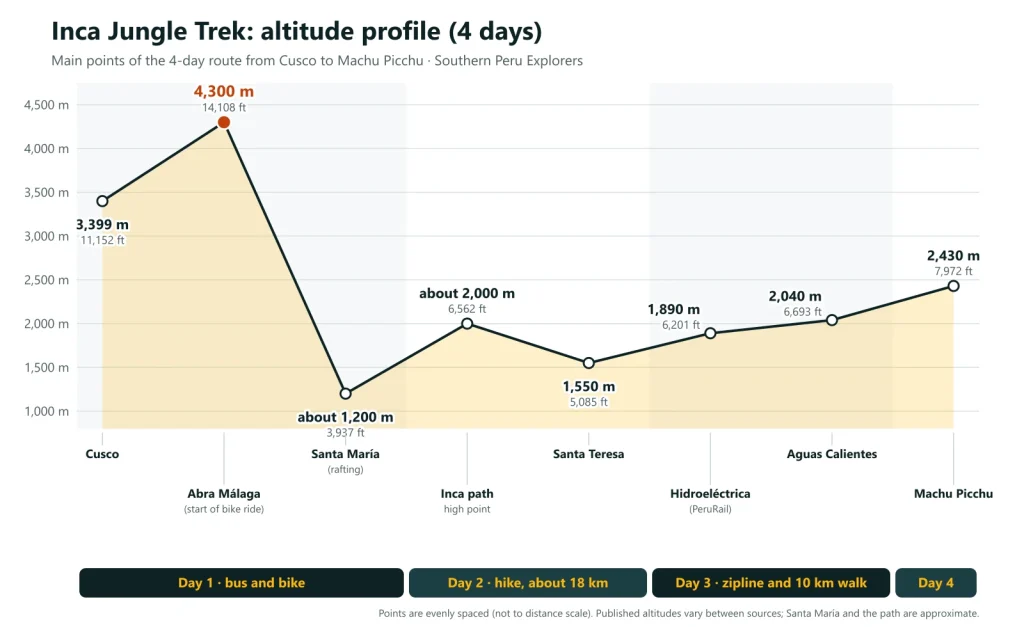
Inca Jungle Trek altitudes#
| Point | Altitude | Day | How you get there |
|---|---|---|---|
| Cusco | 3,399 m (11,152 ft) | Start | Pick-up at your hotel |
| Abra Málaga | 4,300 m (14,108 ft) | Day 1 | By bus; the bike ride starts here |
| Santa María | About 1,200 m (3,900 ft) | Day 1 | By bike; rafting in the afternoon |
| High point of the Inca path | About 2,000 m (6,600 ft) | Day 2 | On foot (4-day tour) |
| Santa Teresa | 1,550 m (5,085 ft) | Day 2 | On foot (4-day tour) or by vehicle (3-day tour) |
| Hidroeléctrica | 1,890 m (6,201 ft), according to PeruRail | Day 3 | By vehicle, after the zipline |
| Aguas Calientes | 2,040 m (6,693 ft) | Day 3 | On foot along the railway |
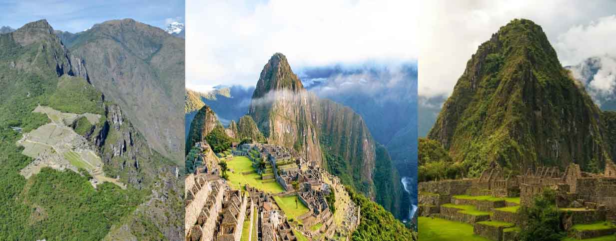
| Machu Picchu | 2,430 m (7,972 ft) | Day 4 | By bus or on foot up the stone steps |
Published altitudes vary between sources. Santa María and the high point of the path are approximate: they come from map and terrain data, as there is no official figure.
The route day by day#
Day 1: Cusco – Abra Málaga – Santa María (from 4,300 m down to about 1,200 m)
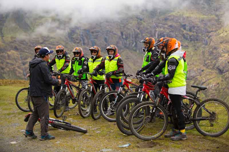
We drive from Cusco (3,399 m) through the Sacred Valley and Ollantaytambo and climb by road to Abra Málaga, the pass between the Andes and the high jungle. It is cold at the top. After the safety briefing you ride downhill for about 45 km, around 3 hours, through cloud forest, small villages and fruit orchards towards Santa María. In one morning you lose about 3,000 m of altitude, so the air gets much warmer: take off layers as you go. In the afternoon you go rafting on level III rapids, and the night is in the house of a local family in Pispitayoc.
Day 2: Pispitayoc – Quellomayo – Santa Teresa (up to about 2,000 m)
The hiking day: about 18 km, around 8 hours, on a section of an old Inca path above the valley. The path climbs to about 2,000 m, with views over the river, and passes coffee, coca, banana and fruit farms. After lunch in Quellomayo it continues to Santa Teresa (1,550 m), where you sleep in a hotel and can visit the Cocalmayo hot springs. It is hot and humid, so carry water and sun protection.
Day 3: Santa Teresa – zipline – Hidroeléctrica – Aguas Calientes (1,550 to 2,040 m)
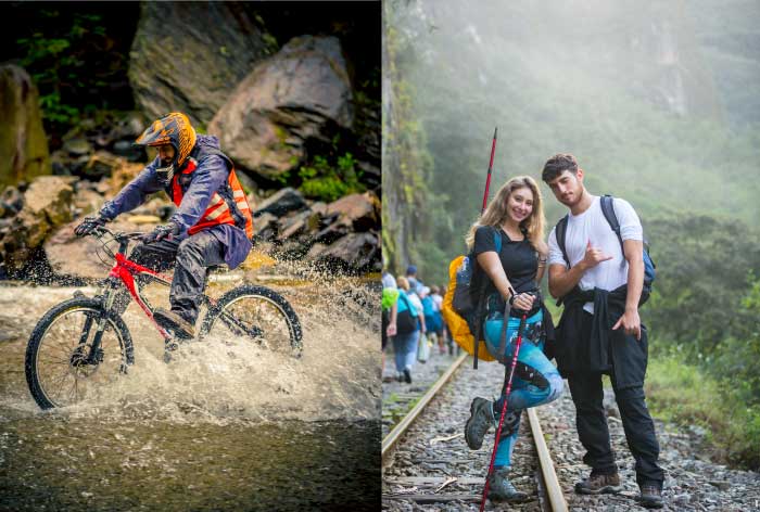
In the morning you cross the valley on the zipline course in Santa Teresa. Then we drive to Hidroeléctrica and walk about 10 km, around 3 hours, along the railway and the river to Aguas Calientes (2,040 m). The path rises gently all the way, so it is an easy walk.
Day 4: Machu Picchu (2,430 m) and return to Cusco
Machu Picchu is about 390 m above Aguas Calientes. You go up by bus (not included) or on foot up the stone steps, which takes longer and is steep. After the guided visit you take the train to Ollantaytambo and our bus back to Cusco.
The 3-day version
On the Inca Jungle Trail 3 Days, day 1 is the same, but after rafting you transfer by vehicle to Santa Teresa, about an hour away, without the hiking day. The highest point is still Abra Málaga, reached by bus.
Altitude and altitude sickness#
Altitude is less of a problem on the Inca Jungle than on the other treks to Machu Picchu. You reach the highest point, Abra Málaga, by bus and leave it on the bike after the safety briefing, and after the first morning you stay below 2,500 m until you return to Cusco. By comparison, on the Classic Inca Trail you climb on foot to 4,215 m, and on the Salkantay Trek to 4,630 m.
Cusco itself is at 3,399 m, so spend at least two days there before the tour; see our guide to altitude sickness in Cusco.
Our Inca Jungle tours#
- Inca Jungle Trek 4 Days: USD 420, biking, rafting, the Inca path hike, the zipline and Machu Picchu.
- Inca Jungle Trail 3 Days: USD 390, without the hiking day.
Read the full Inca Jungle Trek guide and compare it with other routes in Inca Jungle vs Salkantay.
Frequently asked questions#
What is the highest point of the Inca Jungle Trek?
Abra Málaga, at about 4,300 m (14,108 ft). You reach it by bus, and it is where the downhill bike ride starts.
What is the lowest point of the Inca Jungle Trek?
The valley around Santa María, at about 1,200 m (3,900 ft), at the end of the bike ride on day 1.
Is altitude sickness a problem on the Inca Jungle Trek?
Less than on the Inca Trail or the Salkantay, because you do not walk at high altitude. You only spend a short time at Abra Málaga, and from day 2 you stay below 2,500 m. Acclimatize in Cusco first.
How far do you bike and walk on the Inca Jungle Trek?
About 45 km by bike on day 1. On foot, about 28 km on the 4-day tour (about 18 km on day 2 and 10 km on day 3) and about 10 km on the 3-day tour.

Written by Joel Cárdenas Gonzales
Founder & CEOFounder and CEO of Southern Peru Explorers since 2009. Born in Cusco and trained as an official tour guide at Instituto Khipu. About the author