The Choquequirao trek is a hike of usually 4 or 5 days from Capuliyoc, above the village of Cachora, down into the Apurímac canyon and up to Choquequirao, an Inca site at about 3,050 m that can only be reached on foot. Our 5-day trek is about 64 km there and back, with a descent and a climb of about 1,400 m on each side of the river, so it is hard work even though it stays lower than the Inca Trail. You can also continue from Choquequirao to Machu Picchu in 7 days. This guide covers the site, the route, the difficulty, tickets, the best season and the cost.
What is Choquequirao?#
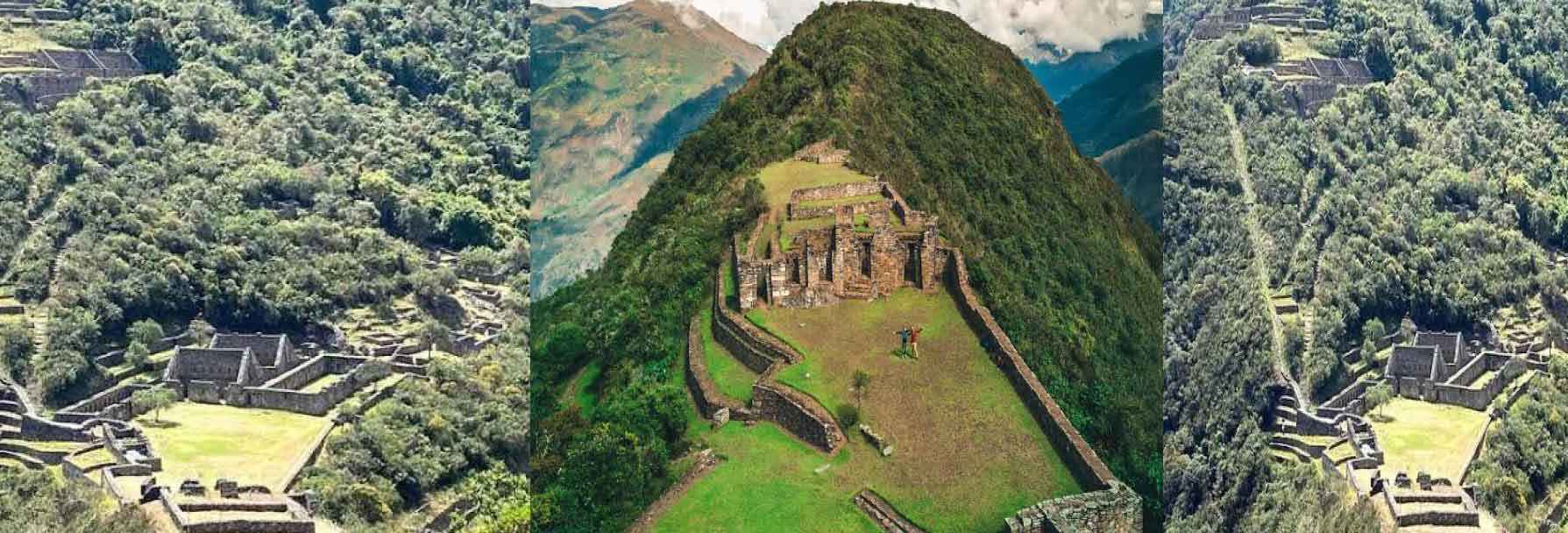
Choquequirao is an Inca site on a mountain spur above the Apurímac River canyon, in the Santa Teresa district of La Convención province, Cusco, at about 3,050 m above sea level. Its name is usually translated as “cradle of gold”. It can only be reached on foot: there is no road, and the cable car planned by the government has not been built (in October 2026 the project still had no concessionaire). That is why it receives only around 9,000 visitors a year, according to the regional tourism office, compared with more than 1.5 million at Machu Picchu.
Choquequirao history
Choquequirao was built by the Incas. A study by the Ministry of Culture in Cusco links it to the ruler Pachacútec, with later expansion possibly under Túpac Inca Yupanqui, and it is associated with Vilcabamba, where the last Incas resisted the Spanish from 1537 to 1572. Written references to the site go back to 1661 and 1710, and Hiram Bingham visited it in 1909, two years before he reached Machu Picchu.
What to see at Choquequirao
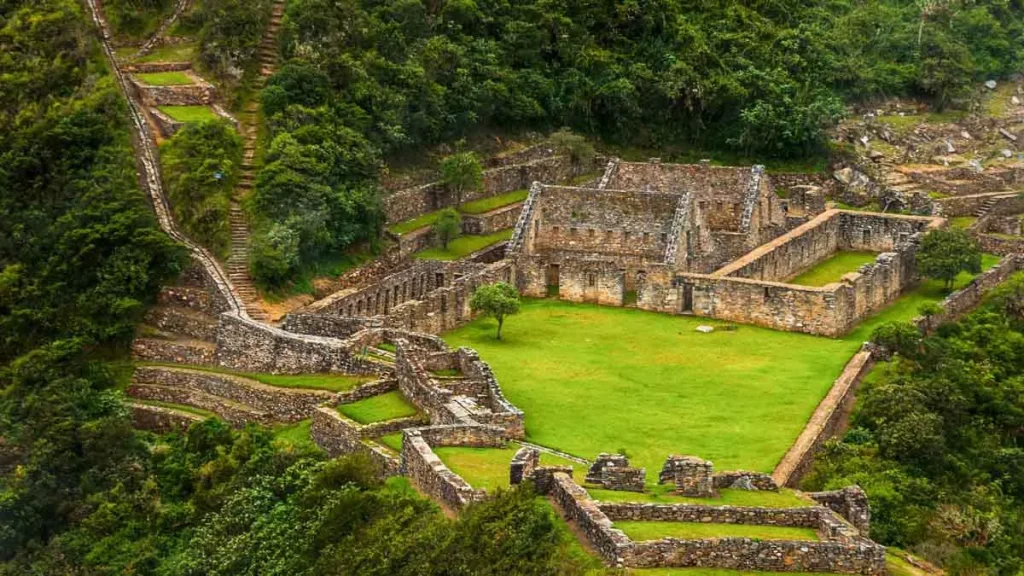
- The main plaza: the ceremonial centre of the site, with two-storey buildings (kallankas) and temples around it.
- The usnu: a ceremonial platform on a levelled hilltop that overlooks the main plaza.
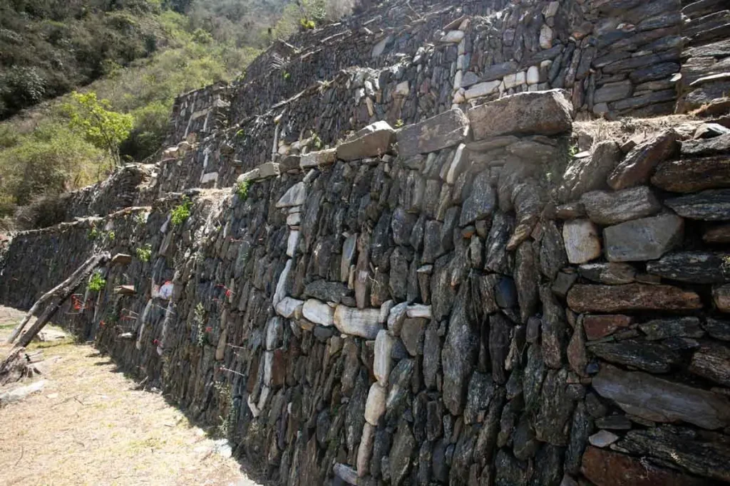
- The Llamas terraces: on the slope west of the main plaza, terrace walls with figures of llamas made in white stone. They were cleared and restored from 2005.
- Canals, fountains and farming terraces spread over the steep slopes around the centre.
Only part of the site has been cleared, and the archaeologists who have worked there divide it into different numbers of sectors, so names vary between maps. Your guide will show you the main areas on a day at the site.
Visiting Choquequirao: tickets, hours and access
- Entrance: S/ 60 general, S/ 30 for students and S/ 25 for children, the same for all nationalities (Ministry of Culture tariff). On our tours we get the ticket for you.
- Opening hours: 7:00 a.m. to 4:00 p.m.
- Access: the usual route starts at Capuliyoc, above the village of Cachora (Apurímac), about 4 hours by road from Cusco; there are also routes from Huanipaca and from the Santa Teresa side.
- Rainy season: entry was suspended from 1 February 2026 because of heavy rain, and the Ministry of Culture announced the reopening of the Capuliyoc–Cachora route from mid-April 2026. Check the conditions before you travel between January and April.
- Permits: you do not need an Inca Trail permit, only the Choquequirao entrance ticket (and a Machu Picchu ticket if you continue there).
Our 5-day Choquequirao trek#
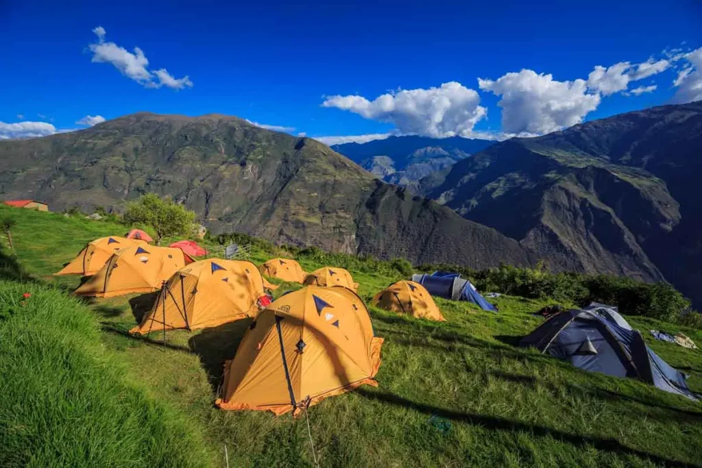
Our 5-day trek starts at Capuliyoc, reaches Choquequirao and returns the same way. We camp at Chikisca, Marampata, Santa Rosa and Chikisca again. Unlike the 7-day route, it does not continue to Machu Picchu.
Do not forget good boots, trekking poles, sunscreen, insect repellent and clothes you can wear in layers. See our Choquequirao Trek 5 Days, or compare both routes on our Choquequirao tours page.
Choquequirao trek at a glance#
| Choquequirao Trek 5 Days | Choquequirao to Machu Picchu 7 Days | |
|---|---|---|
| Price per person | USD 680 | USD 1,350 |
| Route | Capuliyoc – Choquequirao and back the same way | Capuliyoc – Choquequirao, then over the San Juan pass to Machu Picchu |
| Distance | About 64 km (40 miles) | About 97 km (60 miles) |
| Nights | 4 camping: Chikisca, Marampata, Santa Rosa, Chikisca | 5 camping (Chikisca, Choquequirao, Maizal, Totora, Lucmabamba) and 1 hotel in Aguas Calientes |
| Highest point | Choquequirao, about 3,050 m | San Juan pass, 4,000 m |
| The big challenge | The descent of about 1,400 m to the Apurímac river and the climb back up | The same canyon, plus the descent to the Río Blanco and the climb to the San Juan pass |
| Machu Picchu | Not included | Guided visit on the last day |
The Choquequirao trek day by day#
- Cusco – Capuliyoc – Chikisca: about 4 hours by road to Capuliyoc, then about 4 hours down into the canyon to camp at Chikisca.
- Chikisca – Santa Rosa – Marampata: down to the Apurímac river, then the long climb: about 4 hours 30 minutes to Santa Rosa and 2 hours 30 minutes more to Marampata (2,890 m). The hardest day.
- Marampata – Choquequirao – Santa Rosa: about 2 hours to the site, a guided tour and free time, then down to camp at Santa Rosa.
- Santa Rosa – Chikisca: back across the river and up to Chikisca, about 5 hours 30 minutes.
- Chikisca – Capuliyoc – Cusco: about 5 hours 30 minutes up to the rim, then the drive back to Cusco.
On the 7-day route, day 3 continues from Choquequirao down to the Río Blanco and up to Maizal, then over the San Juan pass to Yanama and Totora, through the cloud forest to Lucmabamba, and by the Inca site of Llactapata to Aguas Calientes. Read the details in our Choquequirao to Machu Picchu trek guide.
How hard is the Choquequirao trek?#
It is rated moderate to challenging, and the difficulty is the canyon, not the altitude. The trail drops about 1,400 m from Capuliyoc to the Apurímac river and climbs about the same on the other side, on stone paths with little shade, and you do it twice, there and back. Day 2, from Chikisca up to Marampata, takes about 8 hours. The highest point on the 5-day trek is Choquequirao itself, at about 3,050 m, so altitude sickness is less of a problem than on the Inca Trail or Salkantay.
Compared with the Classic Inca Trail, which crosses Dead Woman’s Pass at 4,215 m, Choquequirao is lower but has more descent and climb in total and longer, hotter days. You do not need technical skills, but you do need good fitness: regular hiking, stairs or cardio in the weeks before, and 2 or 3 days in Cusco to get used to the altitude.
Best time to hike to Choquequirao#
From April to October, the drier months, when the paths are firmer and the views of the canyon clearer; we recommend May to September. It is hot at the bottom of the canyon in the middle of the day and cool at night at Marampata and Choquequirao. From November to March the trail can be muddy and slippery, and the site can close for some weeks: in 2026 it closed on 1 February and the reopening was announced for mid-April.
What to pack#
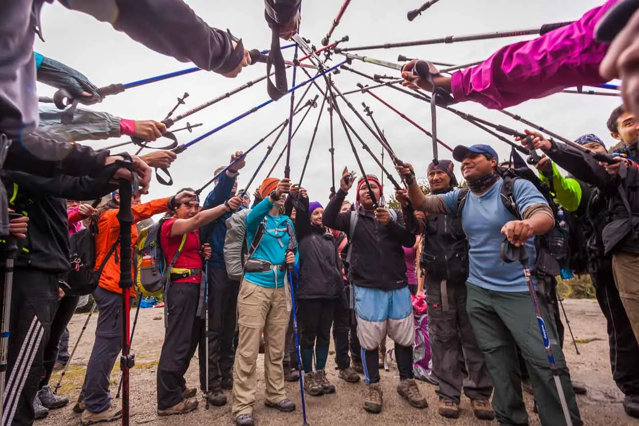
- Broken-in hiking boots with good grip, and trekking poles for the long descents (we rent poles for USD 25)
- Light clothes for the heat of the canyon and warm layers for the nights
- Sun hat, sunscreen and sunglasses: there is little shade on the climbs
- Insect repellent, especially near the river
- A rain jacket from November to March
- A sleeping bag: bring your own or rent one from us for USD 25
- Your passport, needed for the Choquequirao ticket
On our treks horses carry your duffel bag, up to 7 kg including the sleeping bag, so you walk with a day pack.
Wildlife on the trail#
The Apurímac canyon is one of the places near Cusco where you have a good chance of seeing Andean condors flying over the canyon. You also pass hummingbirds, butterflies, orchids and bromeliads in the greener stretches, and on the 7-day route the cloud forest around Lucmabamba.
Choquequirao trek FAQ#
How much does the Choquequirao trek cost?
Our Choquequirao Trek 5 Days costs USD 680 per person and the Choquequirao to Machu Picchu Trek 7 Days costs USD 1,350, with USD 30 off for students. Both include the guide, cook, camping, the horses that carry the gear and the Choquequirao entrance; the 7-day trek also includes Machu Picchu and a night in Aguas Calientes.
Is the Choquequirao trek worth it?
If you want a demanding trek and a large Inca site with very few people, yes. You spend a day at Choquequirao with your guide and often share it with only a few other groups. If you have little time or prefer shorter days, the Inca Trail or a 2-day Inca Trail is a better fit.
Can I continue from Choquequirao to Machu Picchu?
Yes, on the 7-day trek. Instead of returning through the canyon, the route continues over the San Juan pass at 4,000 m and ends with a guided visit of Machu Picchu. See our Choquequirao to Machu Picchu trek guide.
Is there a road or cable car to Choquequirao?
No. The only way in is on foot. A cable car from the Apurímac side has been planned for years, but in October 2026 the project still had no concessionaire.
Is Choquequirao safe?
Yes, with a guide and good preparation. The risks are the steep paths, the heat in the canyon and falls on loose stones, so walk at your own pace, drink plenty of water and use trekking poles.

Written by Joel Cárdenas Gonzales
Founder & CEOFounder and CEO of Southern Peru Explorers since 2009. Born in Cusco and trained as an official tour guide at Instituto Khipu. About the author