This guide is continuously maintained and verified by our resident Andean mountain leaders, ensuring accurate permit guidance, altitude protocols, and route recommendations for travelers in Peru.
Table of Contents (2 Sections)
The Salkantay Trek map shows what each day of the trek covers. Below the map you will find the route, elevations and distances for each stage, so you can prepare for the trek to Machu Picchu.
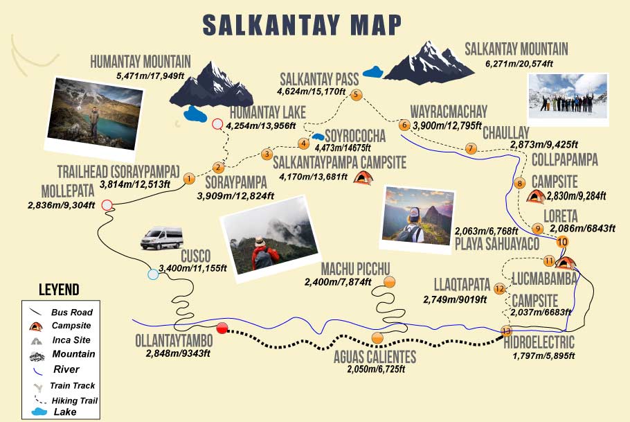
Salkantay Map & Schedule#
Understanding the Salkantay Trek Map#
This section combines visual and textual information to provide a comprehensive overview of the Salkantay Trek route and schedule, ensuring that hikers have all the necessary details for a successful adventure.
The Salkantay Trek is a well-known hiking route in Peru, close to Mount Salkantay (6,271 meters above sea level), which is one of the highest mountains in the Cusco region. The trek crosses several ecosystems of the Peruvian Andes and passes rural communities along the way.
The map shows how the route goes from high mountain terrain down to subtropical valleys. The trek culminates near Machu Picchu, in Aguas Calientes, where you can soak in the historical significance of the ancient Incan city. Each section of the trek presents unique challenges and experiences that contribute to the overall adventure.
DAY 01: The Starting Point
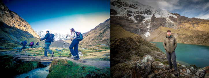
The starting point of the hike is Sayllapata at 3100m / 10,168ft. From here, you will trek towards Sorapampa, where a base camp will be set up for you at 3,800m / 12,467ft. This beautiful setting provides an excellent opportunity to acclimatize to the altitude. The path diverges from the camp to Humanatay Lagoon located at 4,200 meters above sea level, which will be your afternoon excursion. The day’s walk will cover 11km and take approximately 5 hours, depending on your fitness level and walking pace. As you walk, keep an eye out for local wildlife.
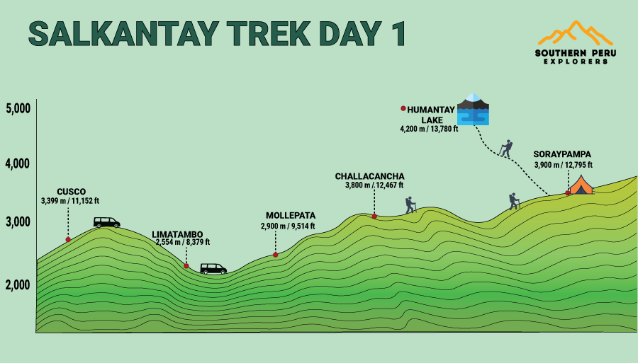
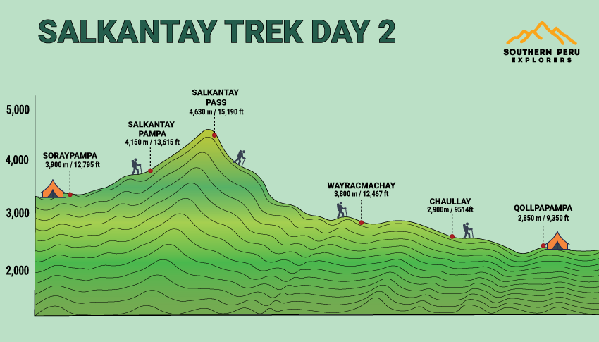
DAY 02: Ascending to New Heights
The route continues onto the Salkantay mountain pass, which lies at 4,600 meters above sea level and is the highest point of the trek. This exhilarating ascent requires determination and stamina, as the altitude can pose challenges. The route traverses the edge of Salkantay mountain (6,271m / 15,090ft) and descends down to Huaracmachay, where the environment begins to transform into a more temperate climate. Following this, you will descend further to Collpapampa at 2,870m / 9,416ft, where the vegetation becomes much greener. This day covers approximately 21km and takes around 9 hours.
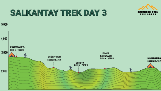
DAY 03: Descending into the Jungle
Leaving Collpapampa, you will ascend slightly before enjoying a relaxed descent for the remainder of the day into the Peruvian Amazon jungle. The lush flora and rich biodiversity of the region will captivate you. The route follows the river for most of the day, with chances to spot local wildlife. As you reach Lucmabamba at 2,140m / 7,021ft, take a moment to appreciate the beauty surrounding you. This day’s walking takes approximately 17km over 6 hours, allowing ample time for breaks and enjoying the scenery along the way.
DAY 04: Discovering Llactapata
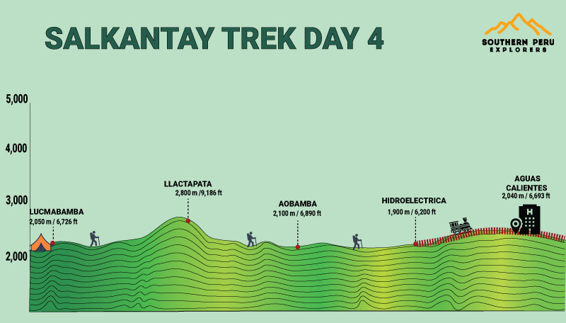
This day starts with a steep ascent to a viewpoint over the surrounding mountains and valleys. Continuing on, you will reach Llactapata at 2,850m / 9,350ft, an Inca archaeological site. The route then drops to the river, and once you are in the valley, it connects to the hydroelectric plant. From there, you will follow the train track into Aguas Calientes, which is located at 2,040m / 6,692ft. This day consists of 20km and takes approximately 7 hours, allowing for exploration and reflection on the cultural significance of the places you encounter.
DAY 05: The Grand Finale at Machu Picchu
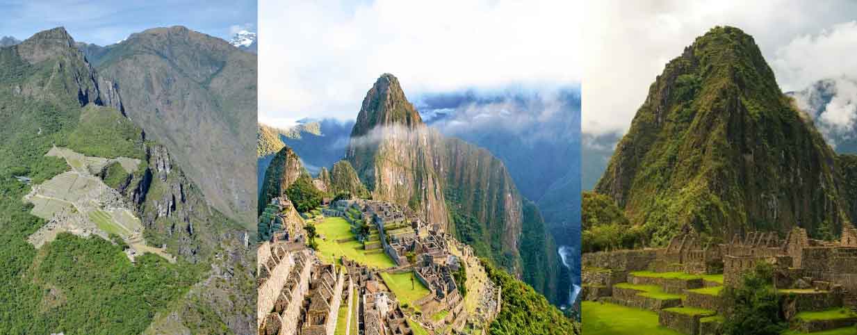
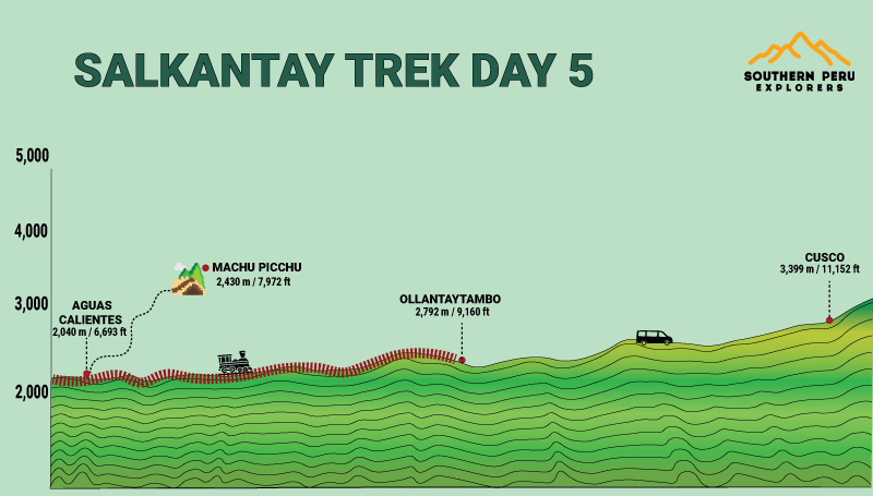
The last day entails traveling either by bus or on foot up to Machu Picchu for an exploration of the ruins. This iconic site, known as the ‘Lost City of the Incas’, is a highlight of the trek, offering a glimpse into the architectural and spiritual prowess of the Inca civilization. After spending time exploring the ruins, you will return the same way down to Aguas Calientes to catch your train back to Ollantaytambo. Reflect on the incredible journey you have undertaken and the memories made along the Salkantay Trek, knowing that this experience will stay with you forever.

Written by Joel Cárdenas Gonzales
Founder & CEOFounder and CEO of Southern Peru Explorers since 2009. Born in Cusco and trained as an official tour guide at Instituto Khipu. About the author