This guide is continuously maintained and verified by our resident Andean mountain leaders, ensuring accurate permit guidance, altitude protocols, and route recommendations for travelers in Peru.
Table of Contents (10 Sections)
- 1 THE INCA TRAIL MAP ALTITUDE
- 2 Inca Trail Map and Altitude Overview
- 3 Day 1: Cusco – KM 82 – Patallacta – Ayapata
- 4 Day 2: Dead Woman’s Pass – Chaquicocha
- 5 Day 3: Chaquicocha – Wiñay Wayna
- 6 Day 4: Wiñay Wayna – Sun Gate – Machu Picchu
- 7 Inca Trail Elevation Profile
- 8 Highest and Lowest Points on the Inca Trail
- 9 Inca Trail Distance and Daily Statistics
- 10 Understanding the Inca Trail Map Before Your Trek
THE INCA TRAIL MAP ALTITUDE#
Planning to hike the legendary Inca Trail to Machu Picchu? Understanding the route, daily distances and altitude changes is an important part of preparing for the trek. Along the way you pass Inca sites, cloud forest and high Andean landscapes.
This comprehensive guide explains the Inca Trail map altitude profile day by day, helping you understand what to expect on the trail, where the highest points are located, and how the elevation changes throughout the journey. Whether you are concerned about altitude sickness, physical difficulty, or simply want to learn more about the route before booking your trek, this guide provides all the essential information you need.
Inca Trail Map and Altitude Overview#
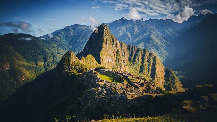
The Classic Inca Trail is a 4-day, 3-night trek that follows ancient stone pathways built by the Incas more than 500 years ago. The route begins at Kilometer 82 in the Sacred Valley and finishes at Machu Picchu, one of the world’s most famous archaeological sites.
Throughout the trek, hikers pass through several ecological zones, including Andean valleys, alpine grasslands, cloud forests, and subtropical vegetation. The constant change in terrain makes the Inca Trail one of the most diverse and rewarding hikes in South America.
Inca Trail Altitude Chart
| Location | Altitude (m) | Altitude (ft) |
|---|---|---|
| KM 82 | 2,600 m | 8,520 ft |
| Patallacta | 2,750 m | 9,022 ft |
| Ayapata Camp | 3,300 m | 10,826 ft |
| Dead Woman’s Pass | 4,215 m | 13,828 ft |
| Pacaymayo | 3,600 m | 11,811 ft |
| Runkurakay Pass | 4,000 m | 13,123 ft |
| Chaquicocha Camp | 3,600 m | 11,811 ft |
| Phuyupatamarca | 3,680 m | 12,073 ft |
| Wiñay Wayna | 2,680 m | 8,792 ft |
| Sun Gate (Inti Punku) | 2,730 m | 8,956 ft |
| Machu Picchu | 2,430 m | 7,972 ft |
The highest point of the entire trek is Dead Woman’s Pass at 4,215 meters (13,828 feet), reached on the second day of hiking.
Day 1: Cusco – KM 82 – Patallacta – Ayapata#
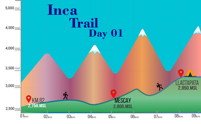
- Starting Altitude: 2,600 m / 8,520 ft (KM 82)
- Highest Point: 3,300 m / 10,826 ft (Ayapata)
- Distance: 14 km / 8.6 miles
- Trekking Time: 6 – 7 hours
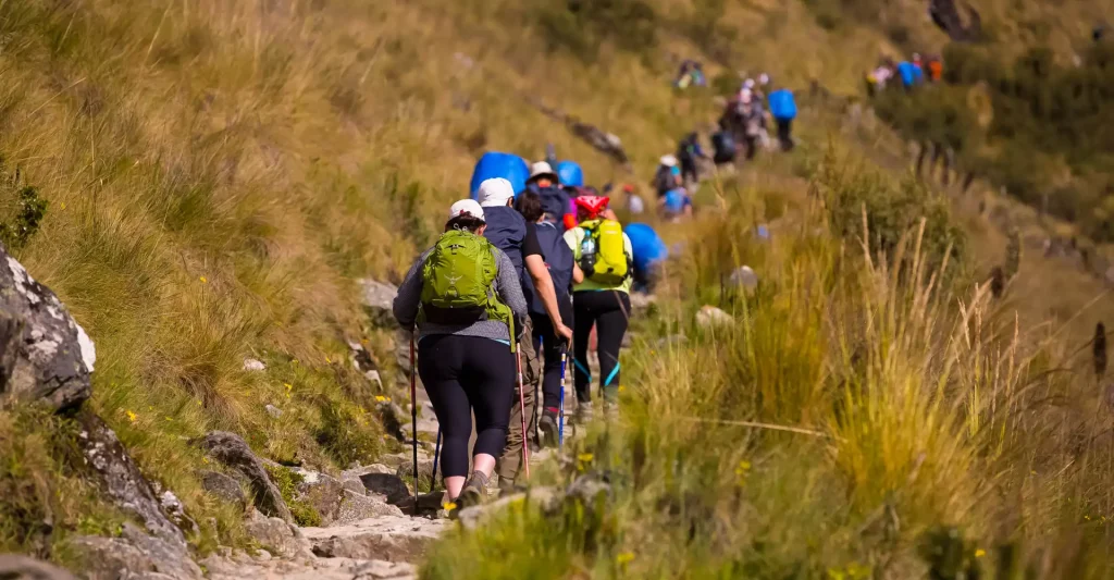
The first day of the Classic Inca Trail is considered a warm-up day, allowing trekkers to gradually adjust to the hiking conditions and increasing altitude.
After departing from Cusco early in the morning, hikers travel to Kilometer 82, the official entrance to the Inca Trail. Here, permits and passports are checked before beginning the journey.
The trail initially follows the Urubamba River through a broad valley surrounded by snow-capped mountains. Along the way, hikers visit Patallacta, one of the first important Inca archaeological sites encountered on the route. This agricultural complex showcases the Incas’ remarkable engineering and farming techniques.
Following lunch, the route begins a gradual uphill climb through eucalyptus groves and traditional farming communities. As the day progresses, hikers gain elevation steadily until reaching Ayapata Camp.
Although the altitude increases significantly during the day, the pace remains manageable, making this stage an excellent introduction to the trek.
Day 2: Dead Woman’s Pass – Chaquicocha#
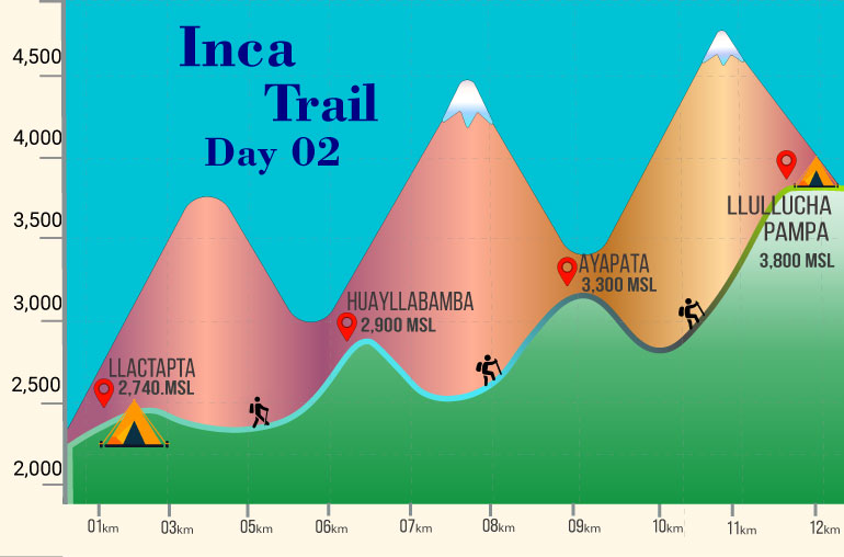
- Starting Altitude: 3,300 m / 10,826 ft (Ayapata)
- Highest Point: 4,215 m / 13,828 ft (Dead Woman’s Pass)
- Distance: 16 km / 9.9 miles
- Trekking Time: 7 – 8 hours
Day two is widely regarded as the most challenging section of the entire Inca Trail.
The morning begins with a steep ascent toward Warmiwañusqa, commonly known as Dead Woman’s Pass. This legendary mountain pass is the highest point on the trail and represents the greatest physical challenge trekkers will face.
The climb is demanding due to both the elevation gain and the reduced oxygen levels at high altitude. However, reaching the summit rewards hikers with spectacular panoramic views of the surrounding Andes Mountains.
After a well-earned rest at the pass, the trail descends into the Pacaymayo Valley where lunch is typically served.
The adventure continues with another climb to the second mountain pass known as Runkurakay Pass, located at approximately 4,000 meters (13,123 feet). Along this section, hikers pass ancient Inca structures and beautifully preserved stone pathways.
The day concludes at Chaquicocha Camp, a peaceful campsite famous for its dramatic mountain scenery and incredible sunset views.
Day 3: Chaquicocha – Wiñay Wayna#
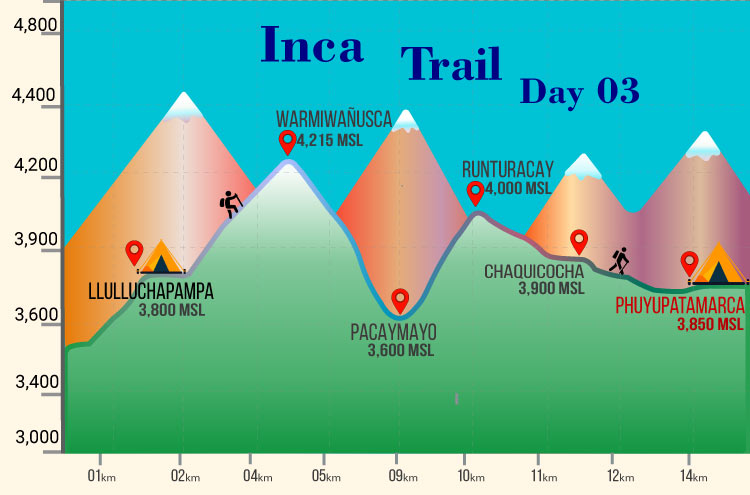
- Starting Altitude: 3,600 m / 11,811 ft (Chaquicocha)
- Highest Point: 3,680 m / 12,073 ft (Phuyupatamarca)
- Distance: 10 km / 6.2 miles
- Trekking Time: 5 hours
For many hikers, day three is the highlight of the entire trek.
Unlike the strenuous climbs of the previous day, this section features gentler terrain and some of the most spectacular scenery found anywhere along the route.
The trail enters the cloud forest ecosystem, where lush vegetation, orchids, hummingbirds, and diverse wildlife can often be observed. The landscape changes dramatically as hikers descend from the high Andes toward the subtropical region surrounding Machu Picchu.
One of the day’s highlights is the archaeological site of Phuyupatamarca, which means “Town Above the Clouds.” This remarkable Inca settlement is often surrounded by mist, creating a mystical atmosphere unlike anywhere else on the trail.
From Phuyupatamarca, a series of ancient stone staircases leads down toward Wiñay Wayna, one of the most impressive archaeological complexes on the entire Inca Trail. The terraces, ceremonial fountains and mountain backdrop of the site show how the Incas lived and farmed here.
Camp is set near Wiñay Wayna, where hikers enjoy their final night on the trail before reaching Machu Picchu.
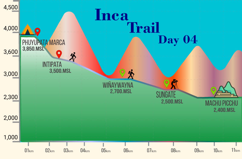
Day 4: Wiñay Wayna – Sun Gate – Machu Picchu#
- Starting Altitude: 2,680 m / 8,792 ft (Wiñay Wayna)
- Highest Point: 2,730 m / 8,956 ft (Sun Gate)
- Machu Picchu Citadel: 2,430 m / 7,972 ft
- Distance: 5 km / 3.1 miles
- Trekking Time: 2 hours
The final day begins before sunrise as hikers prepare for the most anticipated section of the Inca Trail. After passing the final checkpoint near Wiñay Wayna, the trail follows a series of original Inca pathways through the cloud forest toward Inti Punku, commonly known as the Sun Gate.
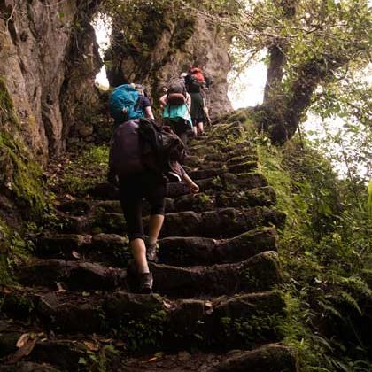
The route includes several stone staircases and short uphill sections before reaching the historic entrance to Machu Picchu. For centuries, this was the ceremonial gateway used by Inca pilgrims arriving at the sacred citadel.
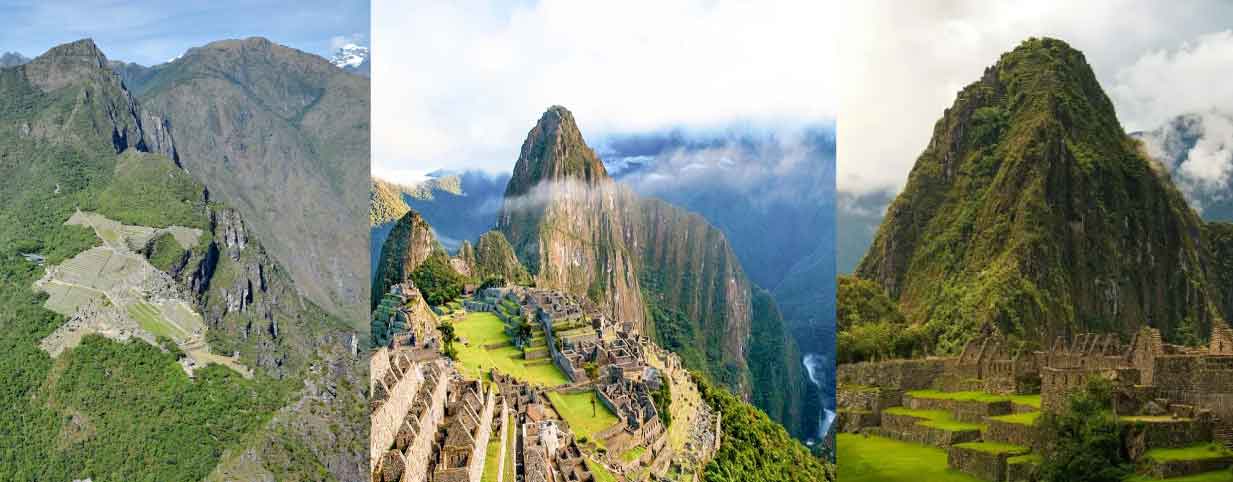
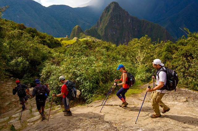
From the Sun Gate, hikers are rewarded with their first panoramic view of Machu Picchu, surrounded by the dramatic peaks of the Andes. This viewpoint offers a unique perspective that is only available to those completing the Inca Trail.
The trail then descends gradually toward the archaeological site, allowing trekkers to enjoy increasingly impressive views of the terraces, temples, and surrounding mountains. Upon arrival, visitors explore Machu Picchu with a guided tour and learn about the history, architecture, and cultural significance of one of the most important sites of the Inca Empire.
The trek ends at Machu Picchu after four days.
Inca Trail Elevation Profile#
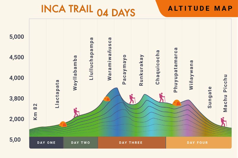
One of the most important aspects of understanding the Inca Trail map is recognizing how the altitude changes throughout the trek. The route begins at 2,600 m (8,520 ft) at KM 82 and gradually climbs through the Sacred Valley before reaching Dead Woman’s Pass, the highest point of the entire trail at 4,215 m (13,828 ft).
After crossing this mountain pass on the second day, hikers descend into the Pacaymayo Valley and continue across a series of ridges, valleys, and cloud forest landscapes. The elevation remains relatively high during the third day before gradually decreasing as the trail approaches Machu Picchu.
These constant altitude changes are part of what makes the Classic Inca Trail such a rewarding experience. Along the route, trekkers encounter dramatically different environments, from high Andean mountain scenery to lush cloud forests filled with native flora and fauna.
Understanding the elevation profile before beginning the trek can help hikers better appreciate the physical challenges and remarkable landscapes that define this historic route.
Highest and Lowest Points on the Inca Trail#
The highest point on the Classic Inca Trail is Dead Woman’s Pass (Warmiwañusqa), located at 4,215 m (13,828 ft) above sea level. Reaching this summit is often considered one of the greatest achievements of the trek, offering spectacular views across the surrounding Andes Mountains.
The lowest point of the route is Machu Picchu, situated at approximately 2,430 m (7,972 ft). Although lower in elevation than most sections of the trail, the citadel is surrounded by steep mountains and subtropical vegetation, creating the unique landscape for which the region is famous.
Between these two points, hikers pass through a variety of ecological zones and several important archaeological sites, making the Inca Trail one of the most diverse trekking routes in South America.
Inca Trail Distance and Daily Statistics#
The Classic Inca Trail covers approximately 42 kilometers (26 miles) over four days. While the overall distance may not seem excessive, the combination of uneven stone pathways, mountain passes, and altitude changes increases the difficulty of the trek.
| Day | Distance | Highest Altitude |
|---|---|---|
| Day 1 | 14 km / 8.6 mi | 3,300 m / 10,826 ft |
| Day 2 | 16 km / 9.9 mi | 4,215 m / 13,828 ft |
| Day 3 | 10 km / 6.2 mi | 3,680 m / 12,073 ft |
| Day 4 | 5 km / 3.1 mi | 2,730 m / 8,956 ft |
Day 2 is generally considered the most demanding section due to the ascent to Dead Woman’s Pass, while Day 3 offers some of the most scenic landscapes along the route. The final day is shorter and focuses on reaching the Sun Gate and Machu Picchu.
Understanding the Inca Trail Map Before Your Trek#
Reviewing the Inca Trail map and altitude profile before your hike provides valuable insight into the route’s daily challenges and highlights. Knowing where the major climbs, campsites, and archaeological sites are located helps trekkers visualize the journey and prepare for each stage of the trek.
The trail passes through a remarkable variety of landscapes and historic locations, including Patallacta, Runkurakay, Sayacmarca, Phuyupatamarca, Wiñay Wayna, and finally Machu Picchu. Each section reveals a different aspect of Inca engineering and showcases the extraordinary geography of the Andes.
Knowing the altitude profile before you go helps you prepare for each day of the route. With Southern Peru Explorers, you will be better prepared for the trek. Book now!

Written by Joel Cárdenas Gonzales
Founder & CEOFounder and CEO of Southern Peru Explorers since 2009. Born in Cusco and trained as an official tour guide at Instituto Khipu. About the author